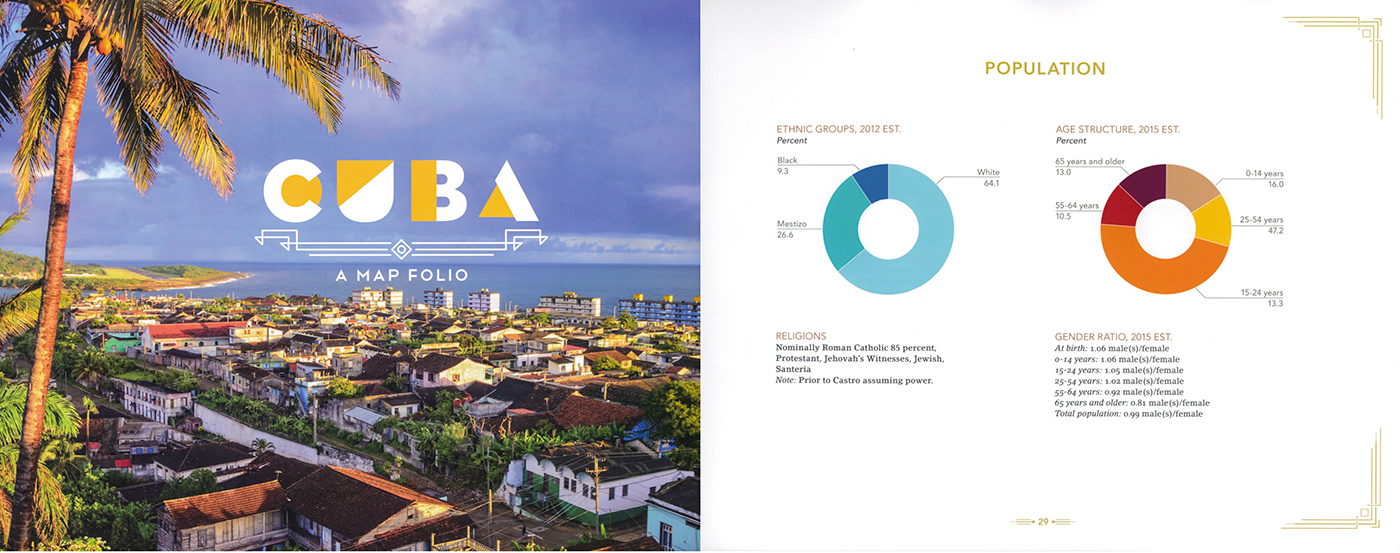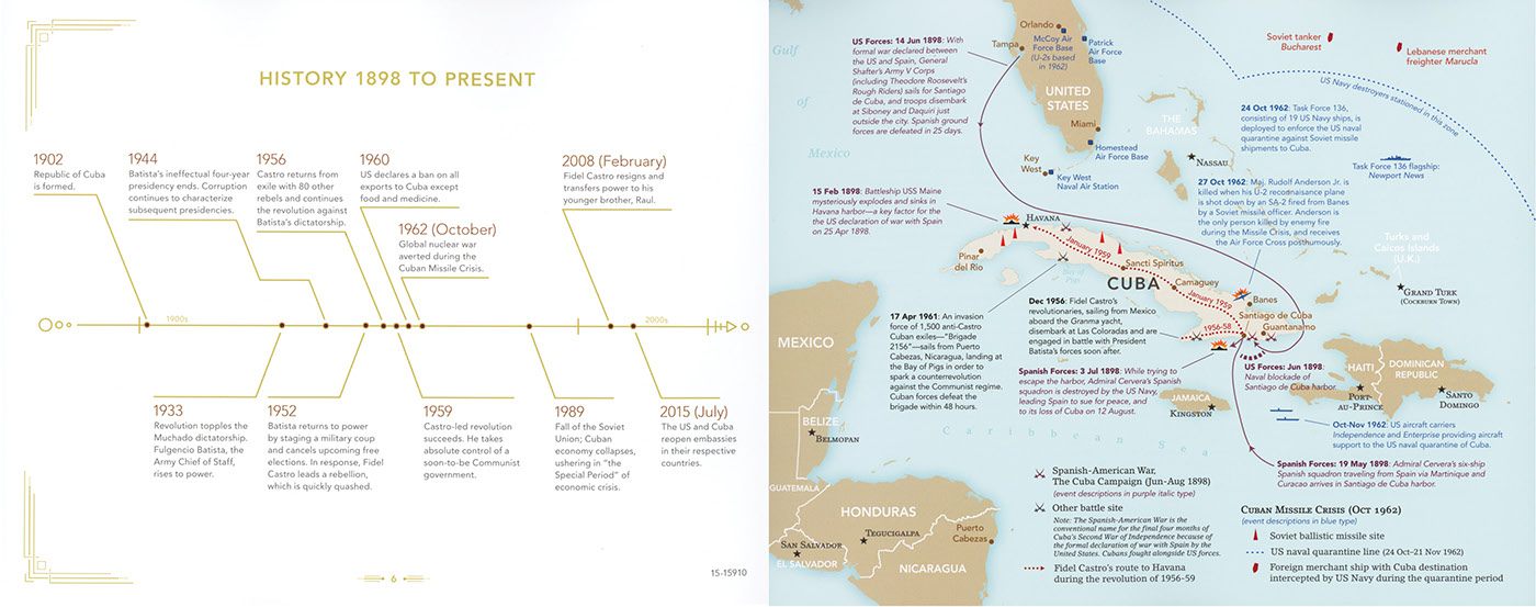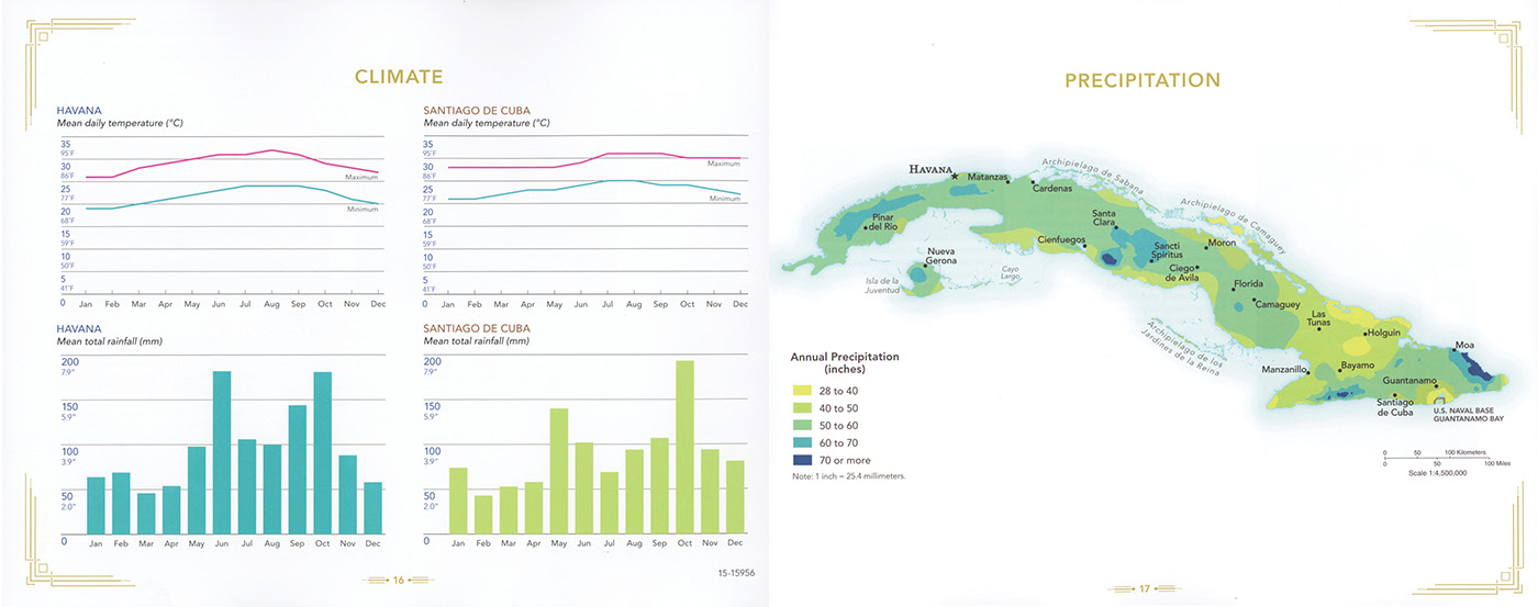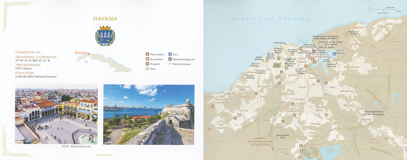


The US Government’s first map folio of Cuba tells the story of Cuba’s history, peoples, economy, geography, and climate with a combination of smart data visualization, sensitive type treatments and design, original cartography, and stunning photography. I art directed and designed this 70+ page publication while working as a designer at CIA in close collaboration with a team of cartographers at the CIA. ICy winner, 2017. The cartography team at National Geographic raved about this project and we received extremely positive feedback from the White House and congressional staff.