Democracy of Public Spaces
River Street
Savannah, Georgia
Collaboration with: Alessandra Andonie
River Street
Savannah, Georgia
Collaboration with: Alessandra Andonie
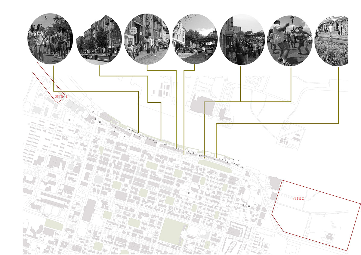
The waterfront is one of the most interesting and prominent parts of a city, and not many cities have the priviledge of having one. Savannah’s River Street has been successful, mostly for tourists, yet it is only partially used. To tackle this problem we took the two ends (perceived) of the waterfront and turned them into parks. By doing this the whole street will be activated and conencted.

Savannah Macro Map
Illustrator & Photoshop
Illustrator & Photoshop

Savannah Map Composition: Land, Buildings, Demographics, Water Masses
Illustrator & Photoshop
Illustrator & Photoshop

Savannah Micro Map:
A) Figure Ground
B) Demographics [Every dot represents 10 people] [Green: Black] [Orange: Black] [Red: Asian]
A) Figure Ground
B) Demographics [Every dot represents 10 people] [Green: Black] [Orange: Black] [Red: Asian]
Illustrator & Photoshop
CONNECTIVITY
CONNECT WITH: CITY AND WATERFRONT
CONNECT WITH: PEOPLE: TOURIST, STUDENT, LOCAL
CONNECT: TWO ENDS OF RIVER STREET
CONNECT WITH: CITY AND WATERFRONT
CONNECT WITH: PEOPLE: TOURIST, STUDENT, LOCAL
CONNECT: TWO ENDS OF RIVER STREET
TRANSPORTATION
BIKE HUBS
VEHICULAR PARKING
REACTIVATE TROLLEY
VEHICULAR PARKING
REACTIVATE TROLLEY
River Street
Illustrator & Photoshop
Illustrator & Photoshop
WEST END PARK:
Both parks are for everyone, yet this park has extra features that attract students. This was made because many student buildings are nearby.

River Street West End Park
Ink, Colors, Photoshop
EAST END PARK:
This is a family park. It has a sports area, recreation area, lawn, and a floating stage.
This is a family park. It has a sports area, recreation area, lawn, and a floating stage.
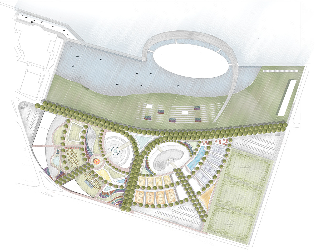
River Street East End Park
Ink, Colors, Photoshop
Ink, Colors, Photoshop
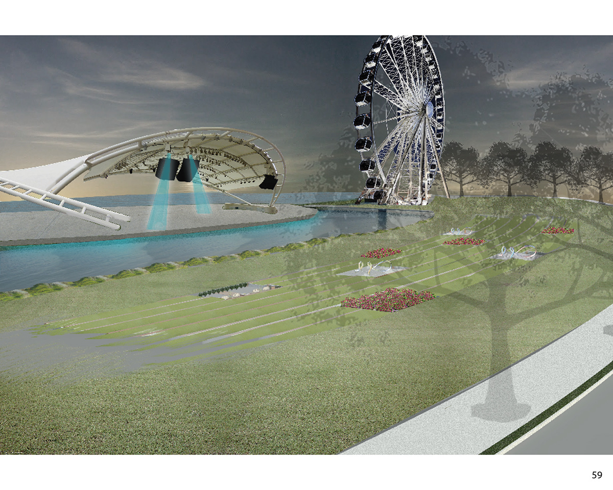
River Street East End Park
Photoshop
Photoshop